About this course
UAV Remote Sensing for Smart Agriculture
Different Data Collection Sensors for a Range of Applications
‘Smart agriculture’, i.e. the efficient use of Earth's resources to feed the world, requires accurate and advanced data acquisition, modelling and management. UAVs can play a critical role in this.
As the world population continues to rise, the demand for food is also increasing. At the same time, a series of global and local challenges are threatening ‘food security’. In this context, various technologies and techniques have been proposed and considered in recent decades to secure the efficient usage of the planet’s agricultural resources, i.e. ‘smart agriculture’. This requires the accurate and advanced acquisition, modelling and management of relevant data. This article presents a brief discussion of how unmanned aerial vehicles (UAVs or ‘drones’) can play a critical role in smart agriculture, including a focus on their capabilities and applications.
What is Smart Agriculture?
Smart agriculture is defined as the application of modern technologies to increase crop yields qualitatively and qualitatively and to improve farming management. It is also known as ‘precision agriculture’ or ‘AgriTech’ in the business world. Smart agriculture is aimed at reducing the costs and risks involved in growing crops, while minimizing the inputs in terms of irrigation, fertilizers, herbicides, pesticides, etc. A major aim of smart agriculture is to efficiently fit between available resources and requirements based on the observed temporal and spatial inconsistency in the crop field.
Smart agriculture brings together a variety of advanced and evolving technologies and applications, including UAVs and satellite remote sensing, sensor networks based on the Internet of Things (IoT), digital-based prediction for insects and diseases, mechanized irrigation, light and heat control, soil management and other associated analytical tasks. Amongst all those technologies, Earth observation (EO) plays an important role in all aspects of pre-diagnosis, modelling and prevention.
As one of the most rapidly advancing aerial EO technologies, UAVs offer advantages over both traditional field measurement techniques and satellite image analysis techniques. A significant amount of time and effort is needed to produce high-quality data from field measurements. In contrast, UAVs offer several advantages:
- Enabling faster, more flexible and more convenient responses to crop-related problems
- Mapping larger crop fields compared to traditional field measurements
- Facilitating Efficient data collection by using different sensors
- Operating even on cloudy days
- Capturing crop information in higher spatial and temporal resolution
- Permitting accurate derived vegetation maps that support better decision-making.
Furthermore, UAV images have several advantages over images gained from satellites or manned aerial photogrammetry:
- Lower impact of clouds due to lower flight height
- Large volume of data captured in a short time
- Full control by the user
- Less affected by the atmosphere
- Lower operating costs.
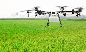
Nowadays, UAVs equipped with an imaging sensor are playing an important role in digital smart agriculture. This technique can be a key element driving improvements in agricultural precision, increases in crop productivity and a greater focus on targeted crop protection.
UAVs can be equipped with different data collection sensors, such as RGB, multispectral (MS), hyperspectral or thermal cameras, or Lidar. Plants reflect light at varying levels depending on their chlorophyll content and biomass. A UAV with a multi or hyperspectral camera measures the reflected energy received from the sun in different areas of the spectrum. The level of energy reflected back from the vegetation and the relation between different spectral bands can enable the health situation of the crop to be indexed. There are various vegetation indexes, including the well-known Normalized Difference Vegetation Index (NDVI) which is based on using the near-infrared (NIR) band. The NDVI is normally used to indicate leaf coverage and plant health, with high NDVI values indicating a high concentration level of biomass. Hence, the NDVI and other vegetation index maps represent great potential for increasing agricultural food production in a more sustainable manner.
 Figure 1: A visualization of the use of UAVs in smart agriculture.
Consequently, spectral data captured using a UAV can be analysed to assess whether the imaged crop is fresh or dry and to localize any areas showing early signs of infection by pests or diseases. Moreover, this spectral information – when combined with 3D information from sources such as digital surface models (DSMs) and waterways maps – can be used to improve the efficiency of activities such as irrigation or pesticide treatment while reducing the amount of inputs required. Figure 1 summarizes the use of UAVs for smart agriculture and shows the connection between sensors, vegetation indexes and applications as outlined below.


